Off the Deck

Off the Deck
Showing posts with label Eastern Indian Ocean. Show all posts

Tuesday, July 31, 2012

India Moves to Protect Vital Sea Lane

Naval base to open 31 July:
Aiming to keep an eye on maritime security around the Malacca Straits, a key sea trading route, the Indian Navy will inaugurate a new air base at the southern-most tip of Andaman and Nicobar Islands.
As you can see from the adjacent map (with the Andaman and Nicobar Islands circled) it's a vital location for maritime security in the region.

More at Defence Express:
The Indian Air Force (IAF) has already tried out its potent frontline Sukhoi SU-30 fighter jets from air bases in the Andaman and Nicobar Islands. The Shibpur airstrip in north Andamans is also planned to be extended from 3,200 feet to 12,000 feet to support all types of aircraft and night-flying operations. Moreover, new airstrips will come up at Kamorta and Little Andaman, while the existing two main runways at Port Blair and Car Nicobar are also being upgraded to facilitate fighter jet, helicopter and heavy transport plane operations. The plans will be implemented in the next few years.

“Plans are afoot to turn Campbell Bay into ‘Operational Turn-Around Bases’ with better refuelling and communication facilities and augmented force levels,” sources added.
And yet more at
"India Now Commands The Strait Of Malacca With Naval Base 'INS Baaz' "
:
Great Nicobar Island, Campbell Bay Circled

The southern most islands of India are closer to Indonesia than mainland India and will help India gain strategic supremacy in the region. The new base will also boast of an upgraded air base that will be able to operate the newly inducted Hercules C-130J Super Hercules which are meant for special forces' operations.

INS Baaz clearly overlooks the Strait of Malacca from across the Aceh in Indonesia. With this new addition to the already powerful Indian navy, India can kickstart operations if maritime activities in the region are threatened. The Strait of Malacca were once heavily infected with piravy but now the Indian and Indonesian navies monitor it for criminal activities by jointly patrolling their maritime borders.
Runway at Campbell Bay, about 3000 feet long

This new base of the Indian Navy comes at a time when the US is re-balancing its force levels from the Atlantic to Asia-Pacific and will base at least 60% of its naval assets in the Asia-Pacific region. The Strait of Malacca acts as a key link between the Indian Ocean and the Pacific Ocean connecting Asia and Africa to East Asia, Australia and the US.

The Indian Navy already operates bases at Port Blair and Car Nicobar in the Andaman and Nicobar Islands chain. INS Baaz is 300 nautical miles south of Car Nicobar naval base and has given the Indian Navy a much wider reach to effectively deter any aggression in the region.

Monday, December 05, 2011

Asian Partnerships: India and Vietnam

Interesting read from the Turkish Weekly analysis on the India-Vietnam Strategic Partnership Getting Stronger:
The India-Vietnam Neighborhood
The relationships between the two countries make a lot of sense when they share common interest- maritime security, fighting terrorism, security of the sea lanes of communications, piracy and natural disasters. Ever since India and Vietnam signed the New Strategic Partnership in 2007, there witnessed significant improvement in a multifaceted ties ranging from political and economic engagements, security and defence cooperation, science and technology and close cultural contacts. Despite Chinese objections, India and Vietnam went a step ahead to signing six agreements encompassing promote oil exploration in South China Sea, extradition treaty, deepen trade, security and strategic ties, etc. *** What makes this relationship special is because of the close understanding that both countries share over the growing rise of China and its subsequent implication on the security of both countries.

India’s ONGC has entered into a deal with a Vietnamese oil company to jointly explore resources in the South China Sea. This move has caused significant alarm in China because it perceive such move is aimed at containing China’s growing clout in the South East Asian region. Vietnam offer for the exploration of resources is part of the gaining strategic understanding between the two countries. However, the Chinese foreign ministry has repeatedly warned India against such moves that amount to interference in China’s relationship with its neighbors. In response to Chinese reaction, Indian Foreign Minister SM Krishna asserted that the exploration projects do not violate international law, and that China’s opposition has no legal basis.

While China on the other hand is steadily increasing its military presence close to India’s borders in Pakistan, Bangladesh, Myanmar and Srilanka. By doing this, Chinese have never thought what would be its implications to India’s security. In recent times, China has expanded its footprint to Pakistan occupied Kashmir, which India claimed to be its own. How can China warn India to remain away when it is expanding close to India’s border and even to India’s claim territory?
Not much doubt about who is believed to be the big threat in the area, is there?

The "post-Cold War world" heads off on a lot of interesting paths.

UPDATE: India is not interested, apparently, in multinational alliances but prefers bilateral agreements, according to this report:
India on Thursday firmly rejected any prospect of joining or forging a trilateral security pact with the US and Australia, remaining steadfast on its long-standing stand of bolstering defence cooperation with other countries on a strictly bilateral basis.
No reason to rattle the Dragon's tail too much, I suppose . . .

Friday, October 14, 2011

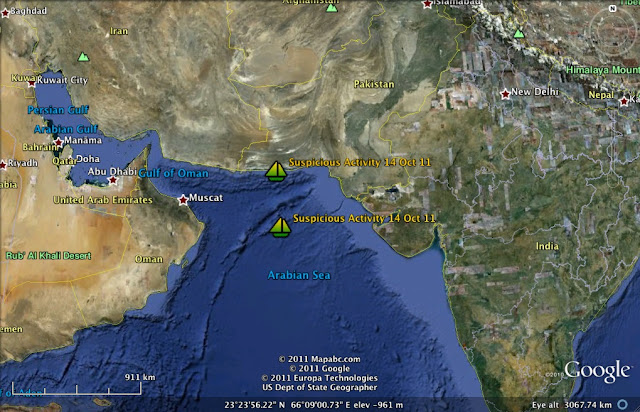
Somali Pirates: Suspicious Activity Near Pakistan

Pirates lurk along commercial shipping lanes
NATO Shipping Center alerts for 14 Oct 11 NSC | All Alerts:
NSC4: Warning- Suspicious Activity 14/10/2011 17:45 2429N 06347E Suspicious Activity
At 1743Z a merchant vessel was approached by 4 skiffs, at approximately 2nm. The skiffs ceased the approach at 1835Z

No weapons were seen.
This situation is in the northern Arabian Sea, near NSC 3: Suspicious Activity.

A broader view. Pirate motherships allow long range operations by the pirates
Masters are encouraged to exercise extreme caution when proceeding through this area.

NSC 3: WARNING - Suspicious Activity 14/10/2011 15:40 2142N 06401E Suspicious Activity
At 1542Z a merchant vessel was approached by 2-3 skiffs in position 2142N 06401E.

These skiffs closed the vessel and gotten within 0.5nm, and is following the vessel astern.

Sunday, August 28, 2011

Somali Pirates: Trained by Pakistan to fight India?


The Times of India has this odd report: India finds proof of Pakistan training Somali pirates:
The evidence was obtained from nine foreign nationals caught from a hijacked Iranian vessel - MV Nafis-1, by the Indian Navy off Mumbai on August 14.

The vessel was brought to Porbandar on August 15 and those arrested - five Yemenis, two Tanzanians, one Kenyan and one Somali national - were handed over to Porbandar police.

Gujarat customs officials had seized a large quantity of food items from the vessel and also found rice packets and juice pouches bearing names of Pakistani companies. Gujarat customs officials also recovered two AK-47s, a pistol and a cache of foreign currency including $86,000 and 1,500 Saudi Riyal.

Officials seized bags full of tea leaves, which customs officials believe, were chewed by the pirates to stay awake.

"The guns have no label but the food items are packed and manufactured in Pakistan. Smugglers are notgenerally found carrying such a large amount of foreign currency," said a senior customs official.
Hmm. Lots of questions here. Is this real? True "Somali pirates"? Or Pakistani contracted foreign agents using a cover of being "Somali pirates" to carry out some nefarious scheme against India? And, does Iran have a role in this or was the MV Nafis-1 really hijacked?

Or what?

Just to fill in a little background, read this report on the Indian Navy capture of the MV Nafis-1 back in mid-August:
The Indian Navy today foiled a piracy attack after it rescued merchant vessel MV Nafis-1, approximately 170 nautical miles west of Mumbai.

The Iranian-flagged vessel had been located by the Navy's Maritime Reconnaissance aircraft on August 12, which thereafter kept it under continuous surveillance.

INS Mysore, a guided missile destroyer, was dispatched to intercept the vessel with two helicopters as well as 24 of the Navy's elite Marine Commandos (MARCOS). The MARCOS carried out a thorough investigation and found two AK-47 rifles and a pistol concealed in an empty fuel tank.

MV Nafis-1 had reportedly sailed from Chah Bahar in Iran to an undisclosed location in July.

Intelligence received by the Indian Navy had indicated that the vessel could have been employed for smuggling or other nefarious activities. Inputs suggest that the vessel was likely to be carrying arms and ammunition, as well as other contraband.
I'm sure this all makes sense. Two AK-47s and a pistol makes for a lightly armed invasion force, though.

Tuesday, May 31, 2011

Somali Pirates: Late May Activity

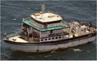
MV Orna
Somali pirates have been somewhat inactive due to sea conditions. See NATO summary here:
The current situation is generally quiet throughout the AOR as the weather is not conducive for pirate operations.

The MV ORNA is underway and last located in the vicinity of 12 17N 062 43E At 302136ZMAY11. She appears to be operating as a Mothership.

A Dhow PAG is probably active in Northern Arabian sea.

In South Red Sea and in the vicinity of Bab al Mandeb Strait a Dhow PAG is probably active based on several attacks in that area.
As set out in part of this NATO Shipping Centre SOMALIA PIRACY UPDATE 31st MAY 2011, much of the activity that has occurred has involved the movement of a suspected pirate mothership, the captured ship MV Orna:
MAY 31,2011
Latitude: 12 58N Longitude: 062 58E
Alert Number 191 / 2011
--- UPDATE UPDATE UPDATE ---
At 1316 UTC / 31 MAY / a previously hijacked ship MV ORNA was reported in position 12 58N 062 58E course 282 / 6.2 kts.
It is likely that this vessel is conduction mothership operations.
___________________________________________
MAY 31, 2011
LATITUDE 13 32N LONGITUDE 042 41E
Alert number 193 / 2011
--- UPDATE UPDATE UPDATE ---
At 0403 UTC / 31 MAY / a merchant vessel was reported under attack by 1 skiff in position 13 32 N 042 41 E.
6 POB in skiff, weapons and ladder reported.
***This vessel managed to evade hijack***
The Pirate action group is still in the area.
________________________________________________
MAY 29,2011
Latitude: 14 44N Longitude: 042 06E
Alert 192 / 2011
At 1157 UTC / 29 May a Merchant Vessel was attacked by two skiffs with six persons on board at position 14 44N 042 06E. Small arms have been fired.
*** vessel managed to evade hijack ***
_______________________________________
MAY 29,2011
Alert Number 191 / 2011
--- UPDATE UPDATE UPDATE ---
At 2252 UTC / 28 May / Hijacked vessel MV ORNA was reported in position 09 32N 058 07E. Course 076 / 8.2 kts
It is likely the ship is being used as a pirate mothership
______________________________________
MAY 28, 2011
Alert Number 191 / 2011
---UPDATE UPDATE UPDATE---
At 0150UTC / 28 MAY / a previously hijacked ship MV ORNA was reported in position 07 57N 055 16E Course 068 / 7.5 kts
It is likely that this ship is being used as a pirate mother ship.
________________________________________
MAY 27, 2011
Latitude 07 09N Latitude 053 20E
Alert Number 191 / 2011
---UPDATE UPDATE UPDATE---
At 0830 UTC / 27 MAY / a previously hijacked ship was reported in position 07 09N 053 20E Coure 078 / 7.5 kts
It is likely that this ship is being used as a pirate mother ship.
________________________________________
MAY 26, 2011
Latitude 06 09N, Longitude 050 33E
Alert Number 191 / 2011
---ALERT ALERT ALERT---
At 0908 UTC / 26 MAY / a previously hijacked ship MV ORNA was reported in position 06 09N 050 33E Course 072 / 7kts
It is likely now that ship is being used as a pirate mother vessel.
The "Orna Track":

Track of MV Orna (click to enlarge)

Sunday, March 27, 2011

Somali Pirates: Indian Forces Stop Pirate Attack, Destroy "Mother Ship" and Captures 16 Pirates

Reported here:
The Indian Navy has foiled an attack by Somali pirates on a merchant ship, west of the Lakshadweep Islands, by apprehending 16 Somali pirates. They also rescued 16 hostages in the process.

Maersk Kensington
"The Maritime Rescue Co-ordination Centre (MRCC) alerted the ships patrolling off the Lakshadweep of a distress message received from merchant ship MV Maersk Kensington at about 11:00 am yesterday and foiled the attack," Defence spokesperson captain M Nambiar said.

Of the 16 rescued hostages (crew members), 12 were Iranians and four were Pakistanis.
More here:
Indian Navy TU-142
'A TU-142 maritime reconnaissance aircraft on patrol located the suspected pirate vessel and facilitated the INS Suvarna, on patrol in the area, to intercept the pirate vessel. Coast Guard Ship ICGS Sangram, also on patrol, was diverted for the operations,' he added.

FV Morteza (NATO photo)
The pirate vessel was identified as Morteza, an Iranian trawler hijacked by the pirates and being used as the mother vessel for piracy operations.

INS Suvarna asked the vessel to stop but the warnings went unheeded and the pirates instead opened fire.

INS Suvarna (offshore patrol vessl) (Indian Navy)
'The pirate vessel Morteza opened fire on the naval ship. INS Suvarna then engaged the pirate vessel in self-defence, resulting in Morteza catching fire due to the fuel drums. The pirates and hostages jumped overboard,' the official said.

INS Suvarna quickly recovered the hostages and also launched a liferaft for the pirates. ICGS Sangram also joined the rescue operations.

ICGS Sangram
'There were 16 Somali pirates and 16 hostages (crew members) of which 12 are Iranians and four Pakistanis,' the official said
UPDATE: What is this, the 3rd or 4th time the Indian's rules of engagement have resulted in the loss of a pirate mother ship, several pirates and the freeing of a number of hostages?

Hmmm.

Sunday, March 06, 2011

Somali Pirates: Unexploded Pirate RPG Round Stuck in Ship Defused As Vessel Nears India

Large Red Arrow Points to Port Sikka Viciinty
An unexploded rifle rocket propelled grenade (RPG) fired a merchant ship during an attack at sea was still stuck in the ship as it neared India. Indian authorities acted to defuse the weapon as reported in "[Indian] Coast Guard, police bomb squad avert major mishap at sea"
A major mishap was averted today following a joint operation of Indian Coast Guard and state police's bomb disposal squad when a rocket propelled grenade thrown inside a cargo vessel by pirates was defused.

The operation was carried out in the vessel MT Agea in the Arabian sea, about 15 nautical miles off the Okha coast in Jamnagar district, coast guard officials said. According to officials, MT Agea, registered in Greece, was on its way to Port Sikka in Jamnagar from Antwerp in Belgium, when it was attacked by pirates, about 400 nautical miles away from Porbander.

RPG laucher and grenade
"The vessel was fired upon with arms and a rocket propelled grenade. One of the grenades hit the accommodation structure and did not explode," they said, adding that the Indian Coast Guard (ICG) regional headquarters at Gandhinagar was intimated about the incident by the vessel.

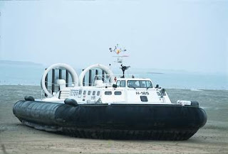
A bomb disposal squad was rushed to the Okha coast where an ICG hovercraft was kept ready for launch, while at the same time the vessel MT Agea was intimated not to enter Gulf of Kutch and anchor about 15 nautical miles off Okha coast.

Indian Coast Guard Hovercraft
"After three hours of operation, the live rocket propelled grenade was disarmed by the police bomb disposal squad, averting a major mishap at sea. The vessel was then cleared for undertaking her passage to Sikka," the ICG officials said.
UPDATE: The original attack and RPG situation was reported here by the ICC CCS:
Site of attack
Attack Number: 2011/095
Date: Fri Mar 04 2011
Vessel Type: Crude Tanker
Location detail: Around 320nm SE of Ras al Hadd, Oman
Attack Type: Fired Upon
Incident Details: 04.03.2011: 09:22 UTC: Posn: 18:35N – 063:47E, around 320nm SE of Ras al Hadd, Oman (Off Somalia).
Armed pirates in a skiff chased and fired upon a tanker underway. All crew apart from bridge team and unarmed security team retreated into the citadel. An unexploded RPG round was noticed on the deck of the tanker. Effective anti piracy measures resulted in vessel evading the boarding. All crew safe.

Thursday, February 17, 2011

Somali Pirates: Tanker Attacked Near India

Early reports of a tanker attack approximately 40 nm off India.

The tanker NS Century reportedly used onboard armed guards to fend off the attack.

NS Century seems to be in the fleet of JSC Novoship.

Details to follow as I learn them.

NS Century photo by Oldkayaker from Shipspotting.com.

UPDATE:
Red arrow points to attack location


More from ICC IMB's Commercial Crime Services IMB Piracy Map 2011
Three skiffs were noticed at a distance of 6.3 nm ahead of a tanker underway. A suspected mother vessel without AIS signal was also noticed via radar around 17nm ahead. The skiffs increased speed and headed towards the tanker. One of the skiffs increased its speed to around 20knots.There were 6-8 persons in each skiff. Master commenced evasive manoeuvres, alerted all crewmembers. The skiffs closed to around three cables and the armed security team onboard fired warning shots.
For those who wonder about such things, a cable is more or less 200 meters (219 meter U.S./185 Brit) or 660 feet +/-).

Tuesday, February 08, 2011

Somali Pirates: OIl Tanker Taken in Middle of Indian Ocean

EU MSC (HOA) reports Italian Oil Tanker Pirated in the Indian Ocean:
In the early hours of 8 February, the Oil Tanker MV SAVINA CAYLYN was pirated approximately 670 nautical miles East of Socotra Island in the Indian Ocean. The vessel was boarded after a sustained attack by one skiff with 5 suspected pirates firing small arms and 4 rocket propelled grenades.

The MV SAVINA CAYLYN has a deadweight of 104,255 tonnes and is Italian flagged and owned. The vessel was on passage to Pasir Gudang (Malaysia) from Bashayer (Sudan) when it was attacked. There is presently no communication with the vessel and no information regarding the condition of the crew of 22 (5 Italian and 17 Indian). The MV SAVINA CAYLYN had registered with MSC(HOA) and was reporting to the UKMTO. EUNAVFOR are monitoring the situation.
NATO report:
February 8, 2011
Latitude: 12°10N Longitude: 066°00E
Alert number 083 / 2011.
At 0427 UTC /08 FEB 11 / a merchant vessel was reported under attack by pirates from 1 x skiff in position 12°10 N 066°00 E.
1 Skiff, 5 POB, was fired upon with small arms and RPG. A mothership was sighted. The vessel was pirated.
The Pirate action group is still in the area.

Sunday, February 06, 2011

Somali Pirates: Indian Navy, Coast Guard capture another pirate ship, 52 arrested

Report that the Indian Navy, Coast Guard capture another pirate ship, 52 arrested:
Arrow points to Lakshadweep Islands
In the second major anti-piracy operation off Lakshadweep in 10 days, the Indian Navy and the Coast Guard today apprehended 52 men including 28 suspected Somali pirates on board a ship after a brief gun-battle near the islands.

The forces foiled a pirate plan to attack a Greek-flagged merchant ship and apprehended Prantalay-11, the sister vessel of fishing trawler Prantalay-14 that was also being used as the mother ship by the sea brigands and was sunk by the Navy in the Arabian Sea earlier.

INS Tir
"Naval ship INS Tir and Coast Guard ship ICGS Samar intercepted the pirates' mother ship Prantalay-11 within Indian waters after a gun-battle and forced the brigands to surrender. A total of 52 men have been apprehended of which 28 are suspected to be Somali pirates," Navy spokesperson Captain M Nambiar said.

Officials said the operation had started last evening when the Navy learnt that MV Chios was being attacked by two pirate skiffs some 100 kms off the Kavaratti island.
ICGS Samar
After receiving the input, Navy's western command here directed the INS Tir and the ICGS Samar, who are already deployed in the region for anti-piracy operations, to rush to the site and apprehend the pirates and their mother ship, they said.

"After locating the skiffs, the two ships asked the pirates to surrender but they fired back at us and fled to their mother ship. After the two ships tracked the mother vessel, they were fired upon again by the pirates," they said.

"The Tir and the Samar returned fire briefly after which the pirates raised white flags to surrender," they said.

NATO Photo of Prantalay 11/14
The pirates and the crew of the Prantalay 11 have now been brought to Mumbai for interrogation by police and intelligence agencies.

UPDATE: It gets better:
‘Stupid’ pirates caught after targeting coast guard ship by mistake
:
A stereotypical depiction of a pirate would be incomplete without the trademark black eyepatch.

The Somali pirates who were arrested by the Coast Guard on Sunday might well have been wearing two.

The Coast Guard nabbed 28 pirates off the Lakshadweep coast in an operation that lasted more than 14 hours.

Their task was made much easier than they expected, after the pirates they were hunting down mistook the Coast Guard vessel on anti-piracy patrol for a merchant vessel and attacked it.

The pirates, riding high-speed skiffs, started firing at the Coast Guard believing it to be a potential target, but were neutralised by a joint team of Indian Navy and Coast Guard after high drama. They are now being brought to Mumbai to be formally arrested.
Well, not "stupid" perhaps, but certainly much mistaken . ..

Saturday, January 29, 2011

Somali Pirates: Indian Navy Destroys Pirate Mother Ship, Captures Pirates

NATO photos of Prantalay
Reported as Navy destroys pirate mother ship, arrests pirates:
The Indian Navy and the Coast Guard in a joint operation on Friday, destroyed a pirate mother ship, Prantalay, off the Lakshadweep group of islands and arrested 15 pirates.

They also rescued 20 fishermen of Thailand and Myanmarese nationalities who were being held hostage by the pirates after Prantalay was hijacked by them on April 18 last year. Since its hijack, the vessel was being extensively used by the pirates to launch attacks on merchant vessels passing along the shipping lanes off the island chain.

Arrow identifies Lakshapweep Islands
“The vessel has been a risk to international shipping for many months and has carried out several attacks,” said the Navy in a media release.
See earlier report on the Indian Coast Guard stopping an attack from this mother ship here.

Good on India.

UPDATE: (30 Jan 11) More here including more details and identification of the Indian Navy ships involved, INS Cankarso, INS Kalpeni, and Indian Coast Guard CGS Sankalp:
There was an exchange of fire between INS Cankarso and the pirate vessel, following which fire was noticed in 'Prantalay' and some personnel were seen jumping into the waters.

Twenty Thai and Myanmarese fishermen, the original crew of the vessel, who had been held hostage by the pirates held hostage for over 8 months and 15 pirates, were pulled out from the waters by INS Cankarso. INS Kalpeni, CGS Sankalp, Naval and Coast Guard ships and aircraft are presently in the area searching for any fishermen or pirates, the release said.

Friday, January 28, 2011

Somali Pirates: Indian Coast Guard plane chases pirates away off Lakshadweep

Indian Coast Guard Dornier
Indian Coast Guard plane chases pirates away off Lakshadweep:
Pirates closing in on a merchant vessel off the Lakshadweep were thwarted by the Indian Coast Guard Friday with its patrol aircraft chasing the sea brigands away through a timely intervention.

The Bahamas-flagged container carrier, MV CMA CGM Berd (E1 note: ?), was sailing west of the Lakshadweep Islands when the Coast Guard's Dornier on a surveillance sortie noticed two skiffs in its vicinity around 10.30 a.m, a Navy official said.

Arrow points to Lakshadweep Islands
Soon, the aircraft descended to pass over the merchant vessel to check on the suspicious activity.

Noticing the Coast Guard aircraft, the pirates abandoned their plans to attack the merchant vessel and quickly sailed away from there, the navy spokesperson said in a press release.

Prantalay, pirate mother ship (NATO photos)
The patrol aircraft crew also sighted the mother-vessel of the pirates identified as merchant ship Prantalay, in the vicinity.

The navy and the Coast Guard rushed their ships to the location to keep a continuous watch on the movements of Prantalay, the spokesperson said.

'Because of the timely arrival of the aircraft, the merchant vessel is now safe and is heading for its next port of call in East Asia,' he added.

Saturday, January 15, 2011

Somali Pirates: South Korean Cargo Ship Taken in the Indian Ocean

Samho Jewelry photo © Henk Noevers from MarineTraffic.com
Reported
here:
A South Korean cargo ship with 21 crew members aboard was hijacked in the Indian Ocean on Saturday apparently by Somali pirates, an official at Seoul's foreign ministry said.

The crew of the 10,000-ton ship, carrying chemical materials, comprises eight South Koreans, two Indonesians, and 11 others from Myanmar, the official said, requesting anonymity.

The ship was sailing from the United Arab Emirates toward Sri Lanka when it was hijacked in the waters between Oman and India shortly after noon (Seoul time), he said, adding that the vessel belongs to Samho Shipping based in the southern port city of Busan.

UPDATE: Hijacking (blue arrow points to estimated spot) laid on the northern part of the latest NATO Shipping Center Warning map:
UPDATE: Changed photo to reflect right ship.

EU's MSC(HOA) report on the hijack here:
On the morning of 15 January, the MV SAMHO JEWELRY was pirated approximately 350 nautical miles South East of the port of Muscat, Oman.

The 19,609-tonne Product tanker is Maltese flagged and Norwegian owned. No further details of the attack are known at this stage. MV SAMHO JEWELRY has a crew of 21 (Myanmar, Korean and Indonesian) and is carrying chemicals. MV SAMHO JEWELRY was not registered with MSC(HOA) and had not reported to UKMTO.
There are unconfirmed reports that the crew initially took shelter in a "citadel" (safe room) but that the pirates were patient and nabbed the crew after waiting 24 hours - see here.

Thursday, January 13, 2011

Somali Pirate Activity 5 Jan - 12 Jan 2011

IMB Piracy Attack Map 2011 Indian Ocean
NATO report on the past week's piracy attacks in the Indian Ocean NATO Shipping Centre: SOMALIA PIRACY UPDATE 12 January 2011
January 12 2011

WARNING INDIAN OCEAN
Latitude: 15°11N Longitude: 058°18E
Alert number 033 / 2011.
At 1453 UTC / 12 JAN 11 / a merchant vessel is currently under attack by 2 skiffs in position 15°11N 058°18E.
----------------------------------------------
January 12 2011
WARNING Gulf of Aden
Latitude: 12°06N Longitude: 044°25E
Alert number 032 / 2011.
At 1046UTC / 12 JAN 11 / 2 merchant vessels were reported under attack in position 12°06N 044°25E.
***These vessels managed to evade hijack***
The Pirate action group is still in the area.
--------------------------------------------
January 11 2011
WARNING Indian Ocean
Latitude: 14°03N Longitude: 067°29E
Alert number 031/ 2011.
At 1342 UTC 11JAN11 a merchant vessel was reported under attack by 1 skiff in position 14 03N 067 29E.
Skiff armed and with ladder.
***This vessel managed to evade hijack***
The Pirate action group is still in the area.
--------------------------------
January 11 2011
WARNING Somali Basin
Latitude: 07°13N Longitude: 055°24E
Alert number 030/2011
At1304 UTC / 11 JAN 11 / a Pirate Action Group consisting of 2 skiffs was reported in position 07 13N 055 24E.
-------------------------------
January 11 2011
--ALERT UPDATE--- Indian Ocean
Latitude: 16°33N Longitude: 059°08E
Alert number 029/ 2011.
Reference previous Alert number 028/ 2011.
At 1021 UTC 11JAN a merchant vessel was reported under attack by 1 skiff in position 16°33N 059°08E.
***This vessel managed to evade hijack***
The Pirate action group is still in the area.
-----------------------------------
January 11 2011
WARNING Indian Ocean
Latitude: 16°33N Longitude: 059°08E
Alert number 028 / 2011.
At 1021 / 11 JAN / a merchant vessel is currently under attack by 1 skiff in position 16°33N 059°08E.
-----------------------------------
January 10 2011
WARNING Red Sea
Latitude: 14°31N Longitude: 42°29E
Alert number 027 / 2010.
At 2241 UTC / 10 JAN / a merchant vessel is currently under attack by pirate skiff in position 14°31N 42°29E. Vsl was fired upon by small arms.
***This vessel managed to evade hijack***
The Pirate action group is still in the area.
-----------------------------------
January 09 2011
WARNING Indian Ocean
Latitude: 17 42N Longitude: 057 17E
Alert number 026/ 2011.
At 0400Z UTC/ 09 JAN/ a Pirate Action Group consisting of skiffs (number unkown) was reported in position 17 42N 057 17E.
---------------------------------------------------
January 08 2011
WARNING Indian Ocean
Latitude: 20 05N Longitude: 062 27E
Alert number 025/ 2011.
At 1110Z UTC/ 08 JAN/ a Pirate Action Group consisting of 1 dhow and 1 skiff was reported in position 20 05N 062 27E.
-------------------------------------------------
January 07 2011
WARNING Indian Ocean
Latitude: 21°08N Longitude: 062°45E
Alert number 023 / 2011.
At 1629 UTC / 07 JAN / a merchant vessel was reported under attack by 2 skiffs in position 21°08N 062°45E. Two skiffs with larger skiff in vicinity. Two skiffs fired small arms, larger skiff is 50m.
**This vessel managed to evade hijack***
The Pirate action group is still in the area.
--------------------------------------------
January 06 2011
WARNING Indian Ocean
Latitude: 04°19S Longitude: 047°02E
Alert number 022 / 2011.
At 0940 UTC / 06 JAN / a Pirate Action Group consisting of one white whaler and one blue skiff was reported in position 04°19S 047°02E.
--------------------------------------------
NATO Alerts as of 11 Jan 11
January 06 2011
WARNING Indian Ocean
Latitude: 21°04N Longitude: 063°19E
Alert number 021 / 2011.
At 0901 UTC / 06 JAN / a merchant vessel is currently under attack by 2 skiffs.
Two skiffs, vessel has been fired upon.
--------------------------------------------
January 06 2011
WARNING Indian Ocean
Latitude: 20°30N Longitude: 064°03E
Alert number 020 / 2011.
At 0232 UTC / 06 JAN / a merchant vessel was attacked by one pirate skiff.
***This vessel managed to evade hijack***
The Pirate action group is still in the area.
(Alert number 019 now cancelled)
-------------------------------------------
January 05 2011
WARNING Indian Ocean
Latitude: 04°00N Longitude: 051°58E
Alert number 018/2011
(Reference previous alert number 008 / 2011, now deactivated)
At 1354UTC / 05 JAN 11 / pirated MV YORK conducting mother ship operations was reported in position 04°00 N 051°58 E, course 290°, speed 6.5 kts.
IMB Live Piracy Map can be found here.

UPDATE: Report of a dhow with 14 Indian seafarers being captured here:
An Indian dhow MSV Al-Musa sailing from Dubai to Salalah has been attacked by pirates off the coast of Oman. According to India’s directorate of shipping, pirates have taken about 14 Indians hostage.

The incident occurred on Sunday when the dhow was sailing at about 50 miles off Oman and about 800 nautical miles from the Somali coast carrying food items.

Wednesday, December 15, 2010

Somali Pirates: Activity Since 10 Dec 10

Somali Pirate Activity Areas 10 Dec-14 Dec 2010. Distance Point A to Point B is approx 2400 miles. Attack farthest east of Somali took place about 1000 miles off Somalia.


From the U.S. Navy Office of Naval Inteligence:
Anti Shipping Activity

Type of Search:   All Anti-Shipping Activity Messages
Pirate Attacks North Indian Ocean 10-14 Dec 2010
Pirate Attacks Eastern Mid-Indian Ocean 10-14 Dec 2010
Date Search:   None
Sort Order:   Descending Date of Occurrence
space
Date of Occurrence: 12/13/2019 Reference Number: 2010-527
Geographical Subregion: 62 Geographical Location: 13° 09' 00" N
48° 29' 00" E
Aggressor: PIRATES Victim: MERCHANT VESSEL
Description: GULF OF ADEN: Merchant vessel attacked in 13-09N 048-29E at 131000Z Dec. Vessels are advised to keep 100 miles clear of this position and to exercise extreme caution.

Date of Occurrence: 12/13/2010 Reference Number: 2010-526
Geographical Subregion: 61 Geographical Location: 13° 14' 48" S
54° 43' 00" E
Aggressor: PIRATES Victim: MERCHANT VESSELS
Description: WESTERN INDIAN OCEAN: Pirate activity in 13-14.8S 054-43.0E on 13 Dec. The area involved should be avoided if possible. This area will remain high risk for at least 24-48 hours. Caution advised.

Date of Occurrence: 12/11/2010 Reference Number: 2010-525
Geographical Subregion: 61 Geographical Location: 7° 33' 00" S
42° 05' 00" E
Aggressor: PIRATES Victim: MERCHANT VESSELS
Description: WESTERN INDIAN OCEAN: Piracy action group reported in 07-33S 042-05E at 111030Z Dec. Vessels passing within 100 miles are advised to exercise extreme caution.

Date of Occurrence: 12/11/2010 Reference Number: 2010-524
Geographical Subregion: 63 Geographical Location: 6° 11' 00" N
67° 25' 00" E
Aggressor: PIRATES Victim: MERCHANT VESSEL
Description: SOUTHERN ARABIAN SEA: Merchant vessel attacked in 06-11N 067-25E at 110542Z Dec. Vessels passing within 100 miles are advised to exercise extreme caution.

Date of Occurrence: 12/10/2010 Reference Number: 2010-523
Geographical Subregion: 62 Geographical Location: 20° 51' 00" N
62° 46' 00" E
Aggressor: PIRATES Victim: MERCHANT VESSEL
Description: ARABIAN SEA: Merchant vessel attacked in 20-51N 062-46E at 101504Z Dec. Vessels are advised to keep 100 miles clear of this position and to exercise extreme caution.

Date of Occurrence: 12/10/2010 Reference Number: 2010-522
Geographical Subregion: 61 Geographical Location: 9° 57' 00" S
41° 46' 00" E
Aggressor: PIRATES Victim: MERCHANT VESSEL
Description: WESTERN INDIAN OCEAN: Merchant vessel attacked in 09-57S 041-46E at 101212Z Dec. Vessels are advised to keep 100 miles clear of this position and to exercise extreme caution.

Date of Occurrence: 12/10/2010 Reference Number: 2010-528
Geographical Subregion: 61 Geographical Location: 9° 56' 00" S
41° 48' 00" E
Aggressor: PIRATES Victim: MERCHANT VESSEL
Description: INDIAN OCEAN: A merchant vessel noted being attacked by two skiffs at 1233Z on 10 Dec in position 09-56S 041-48E, approximately 123 miles northeast of Comoros. This area will remain high risk for the next 24-48 hours.

Date of Occurrence: 12/10/2010 Reference Number: 2010-529
Geographical Subregion: 62 Geographical Location: 21° 05' 00" N
62° 44' 00" E
Aggressor: PIRATES Victim: MERCHANT VESSEL
Description: ARABIAN SEA: A merchant vessel noted being attacked by two skifffs at 1550Z on 10 Dec in position 21-05N 062-44E approximately 200 miles southeast of Sur, Oman. This area will remain high risk for the next 24-48 hours.
From the NATO Shipping Center:
December 15 2010
WARNING Indian Ocean
Latitude: 12°07N Longitude: 060°26E
Alert Details: Alert number 540 / 2010.
At 0215 UTC a merchant vessel was reported under attack by 2 skiffs in position 1207N 06026E.
4 POB in skiffs. RPG and machine guns sighted.
***This vessel managed to evade hijack***
The Pirate action group is still in the area.
--------------------------
December 14 2010
WARNING INDIAN OCEAN
Latitude: 18°27N Longitude: 061°50E
Alert number 539 / 2010.
At 0756 UTC 14 DEC 10 a merchant vessel was reported under attack by 2 skiffs in position 18 27N 061 50E.
Mothership was reported nearby. The vessel was fired upon by RPGs.
***This vessel managed to evade hijack***
The Pirate action group is still in the area.
------------------------
December 14 2010
WARNING Somali Basin
Latitude: 05°28 S Longitude: 039°58 E
Alert number 538/ 2010.
At 2200 UTC / 13 DEC 10 / a merchant vessel was reported under attack by 2 x skiffs in position 05 28 S 039 58 E.
2 x speedboats were used. Shots were fired upon the vessel.
***This vessel managed to evade hijack***
The Pirate action group is still in the area.
-------------------------
December 13 2010
WARNING Gulf Of Aden
Latitude: 13°09N Longitude: 048°29E
Alert number 537 / 2010.
At 1000 UTC a merchant vessel was reported under attack by 1 armed skiff in position 1309 N 04829 E.
***This vessel managed to evade hijack***
The Pirate action group is still in the area.
------------------------
December 11 2010
---ALERT UPDATE--- Indian Ocean
Latitude: 06°11N Longitude: 067°25E
Alert number 536/ 2010.
Reference previous Alert number 534/ 2010.
At 0542 UTC / 11 DEC 10 /a merchant vessel was reported under attack by pirates in position 06 11 N 067 25 E.
***This vessel has been hijacked***
-----------------------
December 11 2010
WARNING Somali Basin
Latitude: 07°33S Longitude: 042°05E
Alert number 535/ 2010.
At 1030UTC / 11 DEC 10 / a Pirate Action Group consisting of pirated FV was reported in position 07 33 S 042 05 E.
-----------------------
December 11 2010
WARNING Indian Ocean
Latitude: 06°11N Longitude: 067°25E
Alert number 534/ 2010.
At 0542UTC / 11 DEC 10 / a merchant vessel is currently under attack by pirates in position 06°11 N 067°25 E.
1 skiff with 4POB, small arms and RPG. Mother ship in vicinity of pos 3NM.
-----------------------
December 10 2010
---ALERT UPDATE--- Indian Ocean
Latitude: 21°09N Longitude: 062°45E
Alert number 533 / 2010.
Reference previous Alert number 532 / 2010.
At 101504 UTC a merchant vessel was reported under attack by pirates in position 2051N 06246E.
***This vessel managed to evade hijack***
The Pirate action group is still in the area.
-------------------------
December 10 2010
WARNING Indian Ocean
Latitude: 20°51N Longitude: 062°46E
Alert number 532/ 2010.
At 1504 UTC / 10 DEC 10 / a merchant vessel is currently under attack by pirates in position 20°51 N 062°46 E.
-------------------------
December 10 2010
---ALERT UPDATE--- Somali Basin
Latitude: 10°00S Longitude: 041°51E
Alert number 531 / 2010.
Reference previous Alert number 530 / 2010.
At 101212 UTC a merchant vessel was reported under attack by skiffs in position 0957S 04146E.
***This vessel has been hijacked***
-----------------------
December 10 2010
WARNING Somali Basin
Latitude: 09°57S Longitude: 041°46E
Alert number 530 / 2010.
At 1212 UTC / 10 DEC 10 / a merchant vessel is currently under attack by pirates in position 09°57S 041°46E
NATO "Alert" Areas as of 14 Dec 2010:

Thursday, November 11, 2010

Somali Pirates Take Ship Off India

MSC(HOA) reports MV HANNIBAL II pirated in the Somali Basin:
Early this morning, the MV HANNIBAL II, a Panamanian-flagged vessel, was pirated whilst on route from Malaysia to Suez.

The 24,105 tonne chemical tanker was carrying vegetable oils from Pasir Gudang to Suez at the time. The master of the vessel reported that he had been attacked and boarded by pirates in an area some 860 nautical miles East of The Horn of Africa which is considerably closer to India than it is to Somalia.

The MV HANNIBAL II has a total of 31 crew on board. This number consists of 23 Tunisians, 4 Filipinos, 1 Croatian, 1 Georgian, 1 Russian and 1 Moroccan.


Tuesday, November 09, 2010

Meanwhile - Piracy in the Eastern Indian Ocean and South China Sea Area

Some indication of the more traditional piracy (sea robbers taking things from ships and running away) from ReCAAP. NOTE, however, the first incident about 350 miles off India, where Somali pirates are pushing their envelope, again:

ReCAAP Piracy Summary 2010 through September
24 Oct 10:

Low-grade sea robbery will probably never go away. Somali piracy may be an aberration in the normal course of things, but it will endure until Somalia itself is stabilized.