 |
| Pirate Action 22 Dec 2010 (click to enlarge) |
Report from
NATO Shipping Centre :
December 22 2010
---ALERT UPDATE--- SOMALI BASIN
Latitude: 17°00N Longitude: 062°05E
Alert number 549 / 2010.
Reference previous Alert number 547 / 2010.
At 0428 UTC 22DEC a merchant vessel was reported under attack by pirates/1 grey skiff in position 17 00N 062 05E.
***This vessel managed to evade hijack***
The Pirate action group is still in the area.
------------------------------
December 22 2010
---ALERT UPDATE--- SOMALI BASIN
Latitude: 12°10N Longitude: 060°31E
Alert number 548 / 2010.
Reference previous Alert number 546 / 2010.
At 0312 UTC 22DEC10 a merchant vessel was reported under attack by pirates/1 skiff in position 12 10N 060 31E.
***This vessel managed to evade hijack***
The Pirate action group is still in the area.
-------------------------------
December 22 2010
WARNING SOMALI BASIN
Latitude: 17°00N Longitude: 062°05E
Alert number 547 / 2010.
At 0428 UTC / 22DEC / a merchant vessel is currently under attack by pirates/1 grey skiff in position 17°00N 062°05E.
------------------------------
I
December 22 2010
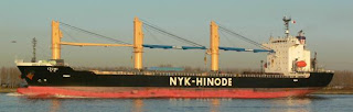 |
| IZUMI |
WARNING SOMALI BASIN
Latitude: 12°10N Longitude: 060°31E
Alert number 546 / 2010.
At 0312 UTC / 22DEC / a merchant vessel is currently under attack by pirates/1 skiff in position 12°10N 060°31E.
-----------------------------
December 22 2010
WARNING Somali Basin
Latitude: 12°22N Longitude: 062°05E
Alert Details: Alert number 545 / 2010.
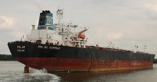 |
| Polar |
At 2341 UTC / 21DEC / MV IZUMI was reported in position 12°22'N 62°05'E heading 127, speed 8kts. Vessel is conducting mother ship operations.
----------------------------
As noted, the captive MV IZUMI is out and about and a warning that the captive MV POLAR is also on the move, believed to be headed to area near the Seychelles.
You might note on the "wind charts" below and in the right column that the winds in the Indian Ocean are not as heavy near the Seychelles and in the area where the above attacks occurred.
 |
| Eastern Arabian Sea |
 |
| North of Seychelles |
 |
| East of Somalia |
 |
| Wind Indicators |
Wind info from
WeatherOnLine.co.uk.


